
I left very early because of rain in the forecast, and started the ride from Ponte San Quirino east of Cividale at 7 AM. The ride up the valley of Torrente Cosizza was very green and cool. A herd of cows rang their bells while munching fresh grass. As I rounded a curve entering Clodig, a gaggle of geese in the road stopped me in my tracks. The leading goose seemed to be looking into the parabolic mirror alongside the road- not sure if he was looking at himself or the other geese. I weaved around the gaggle and continued.
After Clodig I turned left for Drenchia and the narrow lane soon pitched upward. It continues steeply (averaging 10%) for the next 3 km, through a dense mixed forest of beech, oak, and chestnut trees. The pavement was damp; on the steeper parts the rear wheel slipped when climbing out of saddle. This section ended at Trusgne and the road became rolling to almost level. On the right, views of the conch valley of Drenchia captured my attention- tough to keep your eyes on the road here.
After completing a semi-circle along the eastern escarpment of the valley, I reached the turn-off for Rifugio Solarie. This short road starts with a half kilometer averaging 11.7%, then gradually decreases in steepness. The rifugio at 956 meters didn't seem like the end of the road. In fact, it continues into Slovenia and then descends to Tolmin. This would be a good climb to try from the Slovenian side.
But my attention was drawn to a small lane climbing to the north. Signs along the road described the events here at Kolovrat in WW I. Cave-like tunnel entrances disappeared into the ridge. Breathtaking views of Val di Cosizza and the rolling mountains to the south (with a backdrop on clear days of the shimmering Adriatic Sea). The lane continues climbing to 1200 meters altitude. After 4 km pavement ends, but you could continue on the strada sterrata carefully and reach the paved road to Livek and Idresca in Slovenia. This would be a great climb in the opposite direction.
After returning to Rifugio Solarie, I descended via the road to Lombai. The rain held back well into my descent, but finally cut loose and started pouring above Clodig. Luckily the forest was so dense that I didn't get very wet. Then on the open 12 km stretch from Clodig to Ponte San Quirino, the bike and I got a true bagno gratis. I neglected to bring dry clothing to change into, so drove home wrapped only in a blanket. Luckily I wasn't stopped by the police for anything and no tour buses pulled up alongside me at a light.
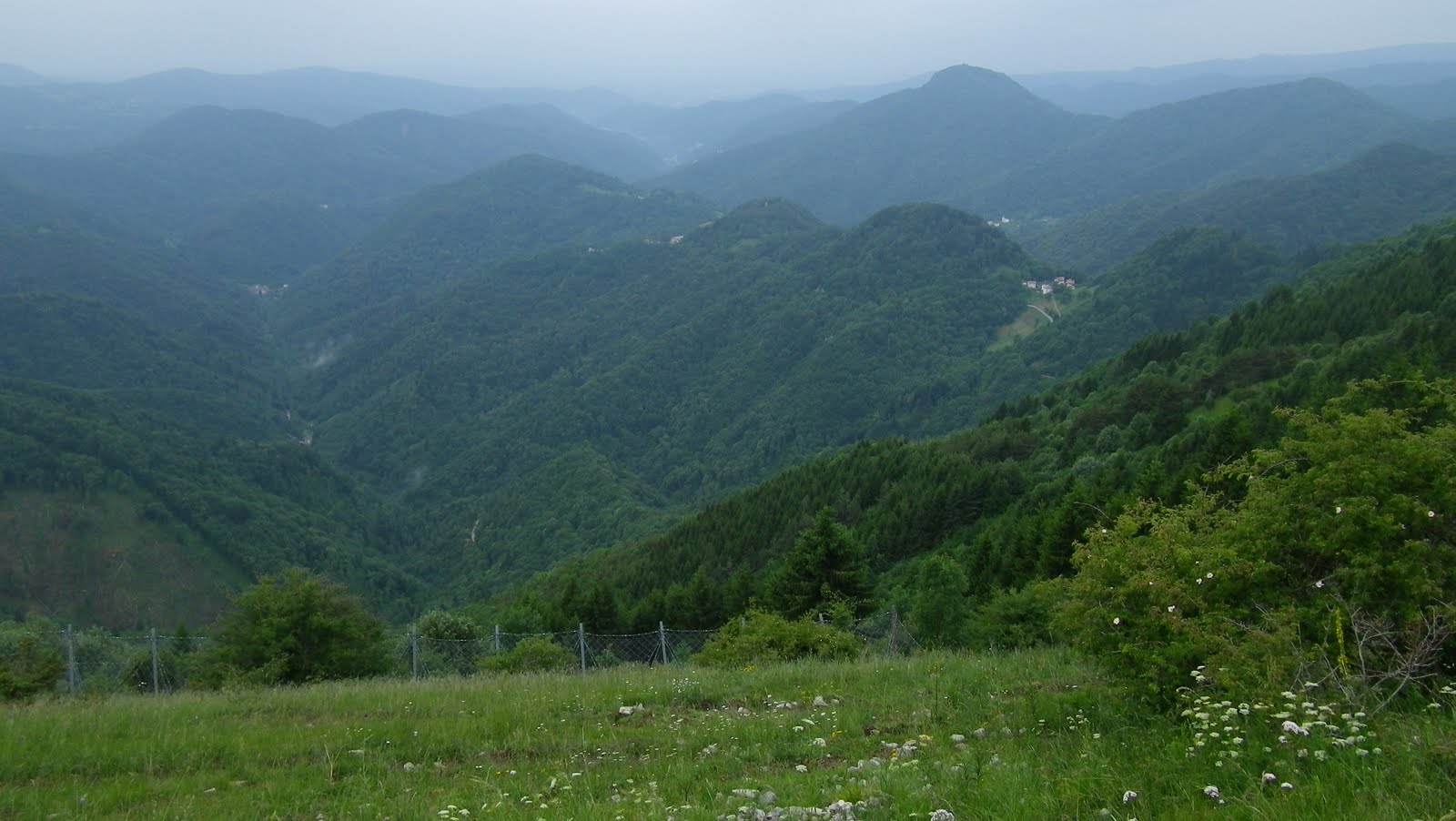 |
| View of the bowl valley of Drenchia |
 |
| Peaks along south flank of Val di Cosizza |
 |
| From Kolovrat ridge road, misty mountains to the south |
 |
| After 4km pavement ends on the small road along Kolovrat ridge; still looks rideable with a road bike though |
 |
| Paved road coming up from Livek in Slovenia |
 |
| Above Rifugio Solarie, the main road continues to Tolmin in Slovenia |

10% average section above Clodig
 |
| A good workout as well as beautiful scenery |


No comments:
Post a Comment
Note: Only a member of this blog may post a comment.